Today was my longest drive so far. I left Pacific Grove around 8 a.m. and headed for 17 Mile Drive. This is a loop toll road that circles around through the Pacific Grove/Pebble Beach/Carmel area. It costs $10.50 but was worth it. A couple of things you need to know: Ask at your entrance gate which direction you should go according to where you want to exit and if you want to take the long or short route. Follow the red dashes in the center of the road! There are many turn-offs from the actual loop road, and you could find yourself back at the beginning without even realizing it. Don't use your GPS. Please benefit from my experience! Below are pictures of several deer I saw along the way. These are not Mississippi deer; they were just several feet away from me. I stopped the car in the road, put my window down, reached out and took their pictures. They just stood there!!!! The last picture is of one of the houses on 17 Mile Road. Most of them had walls too high or too much shrubbery to get a good view.


My next stop was Carmel. What a charming town!! It is actually my favorite when compared to Monterey or Pacific Grove. It had quaint little shops and was an easy walking locale. I could definitely tell that it was all high end, but maybe if I ever return I can find some cheap little corner to stay in. Another reason I wanted to stop here was to see Cypress Inn, the hotel that Doris Day was part-owner of. It was amusing to watch two ladies take each other's pictures outside of the hotel. They kept spinning around and making all sorts of gestures like they were trying to be Doris Day in a film or something. I gave them the benefit of not taking their pictures, but I did snap a photo of a group filming a tv show. The show is called Traveling California.


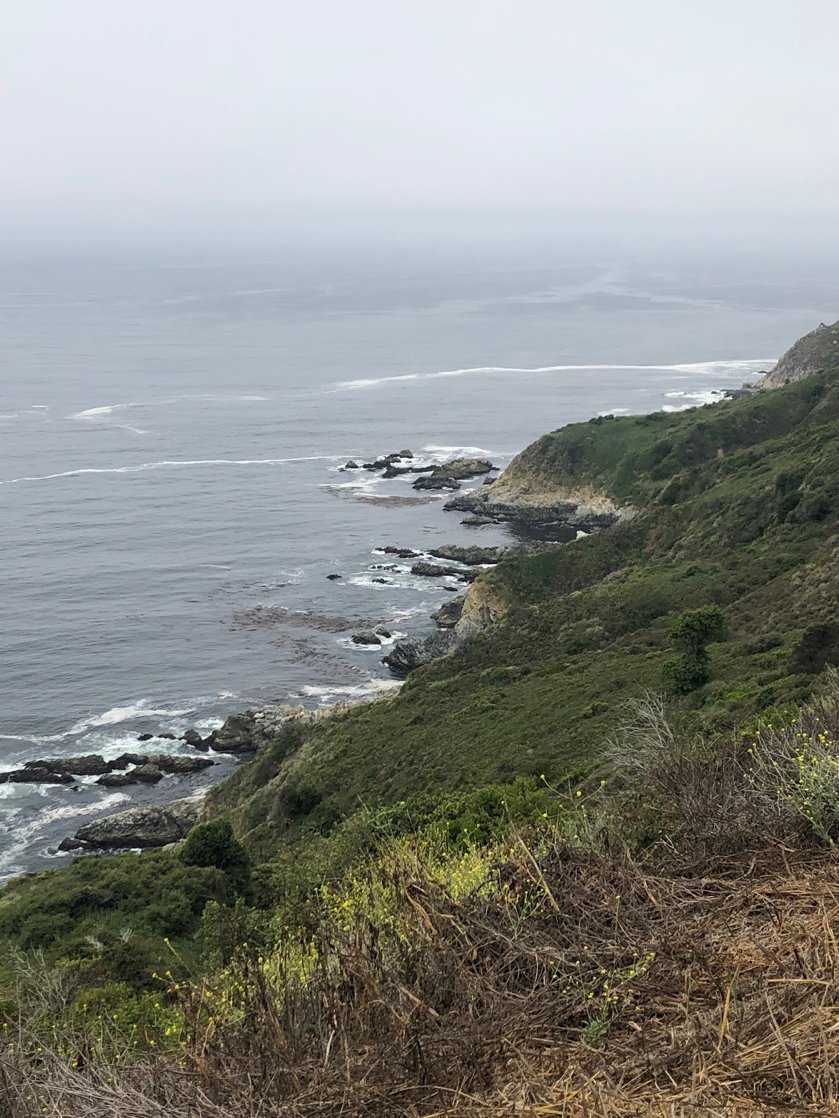
After Carmel I was really on my way. Big Sur! Big Sur is a "rugged section of mountains between Carmel and San Simeon." Highway 1 through Big Sur is a National Scenic Byway. One of the first signs I encountered was:

This sign was No Lie! There were more twists and turns than I could count. Thankfully there were several pull-offs where I could stop and get pictures, and most of the road, even heading south, had wide shoulders. There were just a few spots where I was actually driving VERY close to the edge of a cliff with a non-existent shoulder. I don't have pictures of those spots! Warning: Picture Overload! (I even went through and deleted before I posted.)


I really love Big Sur. I had initially planned to stay somewhere in the mountains, but did not get a room in time. I tried to make a reservation in January! There are several lodges and campgrounds, but if you want to stay in one of them, reserve early! I highly recommend a trip here; I would love to come back and stay about a week at Big Sur Lodge.
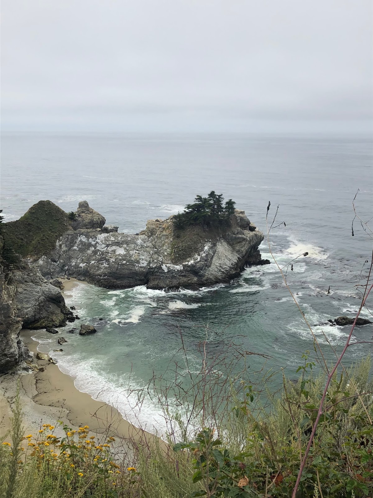
About halfway between Carmel and San Simeon is Julia Pfeiffer Burns State Park. It is operated by the state park system, but don't think park. It's more like a parking lot with a bathroom. The main reason for this state park is it holds the head of the trail which leads to McWay Falls. You don't have to pay the $10 to park in the park, but if you don't you risk getting hit or blocked in when you park on the crowded pullout outside the park. You still have to walk in to get to the trailhead. This waterfall is the only major waterfall in California which falls directly into the Pacific. It is an absolutely gorgeous site. There are several other trails within the Julia Pfeiffer Park, but they were all closed down today. I did walk around around as much as I was able to and found one of my favorite things, a stream. (video below)


This tunnel goes under Hwy. 1 to get to the falls.


The stepping "stones" are giant tree stumps.

After the falls, there were more twists, turns, and bridges. I stopped for lunch near the southern end of Big Sur, at a place called Lucia. It was less of a town and more of a restaurant/store/cabins stop. I ate on a deck overlooking the ocean -- more good views.


In the early afternoon I returned to cellphone coverage as I drove down into San Simeon. The main attraction here is Hearst Castle. I am not a big fan of Hearst, so I will not be paying the $25 to visit. Another big draw to San Simeon, and one I could not resist, is the elephant seal rookery! The males are molting right now, so not much movement at all. You have to follow signs to the seal rookery vista where there's a parking lot (usually full) which enables you to view the seals without fear of your car being hit. The seals are amazing!!!


After checking in to my hotel, I ate a quick dinner and then hit the beach. There are tons of stones here. It is so weird how different each of these beaches is. I am enjoying experiencing these differences as I move south. I got some good beach pictures and some near sunset pictures. I am looking forward to spending a long time at Moonstone Beach, quite near here, tomorrow. I will go complete with long sleeve shirt, a pullover, and a jacket; it is cold here. Sorry heat-wave affected friends in the South.


Then this little guy was right outside my room when I returned:

I have seen SO many animals on this trip. I am really enjoying that!
No comments:
Post a Comment